Google Earth and MSN Virtual Earth are the programs or mapping tools for getting geographic information, but which one is better?
Google Earth and MSN Virtual Earth
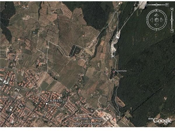
Google Earth is a virtual map and program for geographic information that was first developed by Keyhole Inc. This company was acquired by Google in 2004. It maps the earth by superimposing images obtained by satellite and aerial photography among others. It is also available on iPhone and on all personal computers. People can use a free version or other paid versions that are meant for professionals. It is widely used to locate buildings and for the creation of maps.
Virtual Earth is Microsoft’s effort to compete in the same sphere with a suite of mapping tools that mainly use aerial photographs. Intended to be a search tool that allows users to view street-level images of same areas, Virtual Earth uses a combination of 2D (satellite) and 3D (aerial survey) data. In other words, buildings and neighborhoods can be viewed from directly overhead or at a 45-degree angle. Street maps overlay the 2D and 3D images, and users can add local data layers with emphasis on local businesses.
Note that MSN Virtual Earth is known as “Bing Maps” in Windows Live.
Images
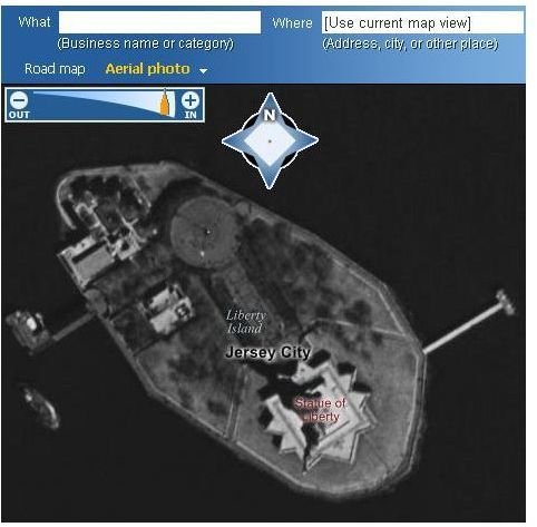
Comparisons - Google Earth vs. MSN Virtual Earth
Virtual Earth from MSN allows resolutions that allow the viewer to get three times closer than in Google Earth.
Virtual Earth has an overlay that is semitransparent and therefore gives better images than Google Earth which shows things one after another.
Virtual Earth has a blogging feature that looks to outdo Google Earth in its interaction with users.
Satellite imagery from Google Earth is far superior to the details shown by Virtual Earth.
Google Earth does not function very well where locating buildings on streets is concerned.
There seems to be some problems for Google Earth where it has mixed up resolutions and quite often shows the same city in different resolutions in different parts of the city. This leads to distorted images.
Virtual Earth seems to be only copying and trying to improve on what Google Earth has done. This is a very continued strategy with MSN where they always seem to be behind in pioneering technology, but once it has been developed by others, they step in and with their vast resources and captive markets overwhelms the other competitors with their copycat technology.
A lot of maps given by Virtual Earth are inaccurate and nowhere near the sophistication that Google Earth has in its interface.
Google Earth has better support for its users than Virtual Earth has.
Google Earth needs you to download its files before you can use the maps. Virtual Earth runs on the MSN servers and through your browser.
Virtual Earth seems to be better for planning trips, but this is only for people in the United States.
Google Earth has an expanded coverage for all areas of the Earth, something that Virtual Earth cannot compete with at the moment.
Virtual Earth enables you to find your own location if you have a Wi-Fi card in your computer. If you do not have a Wi-Fi card Virtual Earth will trace your location from your IP address, but this may only indicate much larger city and country areas.
Virtual Earth is much easier to use than Google Earth. You can scroll with the compass whereas in Google you require to click and drag. Zooming is also much easier and can also be done via the keyboard.
Map space in Virtual Earth is more than in Google Earth
Virtual Earth seems to be concentrating only on the US, whereas Google Earth has recognized the existence of other countries in its virtual world.
Imagery in Virtual Earth is not consistent, which gives Google Earth an edge over it.
Google Earth shows vector maps where no photographs are in existence. Virtual Earth just leaves these places blank.
Google Earth has been much longer in the business than Virtual Earth has, but it is likely that MSN with its vast resources will soon catch up and then dominate the market.