Do you own a Magellan GPS device or are you considering getting one? It doesn’t matter how experienced a user you are, this Magellan guide will help you to fully understand this device and offer brilliant recommendations to get the best performance and usage.
The Magellan brand is a big name in the GPS industry, users can rely on a platform of features that
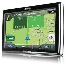
are not only dexterous but also precise in delivering quality GPS data. Magellan developers are responsible for some of the most sophisticated looking units today, those which include widescreen LCD display screens of up to 7-inches (e.g. the RoadMate 1700), 2D and 3D touch screen map displays and some sleek, compact designs. The signature performance of the Magellan brand extends through all their models even though their designs are unique and fitting for different purposes.
We’ve cut through the intricate details, specifications and jargons to break down and present to you this amazing Magellan guide to help showcase the best types of devices for specific needs and how to fully operate and utilize all its functions. Also find out where to locate the best maps and updates, as well as the best options for outdoor excursions.
Your Top Options
How do you choose? Whether you decide to go with the RoadMate, Maestro, Triton or eXplorist, it appears you can’t go wrong. But narrowing down which devices are best for you, all depends on what you are looking for and the purpose for your purchase. If you love touring and exploring new places then you could perhaps consider the RoadMate 3065 GPS unit, it has a whopping data base of over six million POIs (points of interests), which means you are bound to get information on a handful of special places for just one location. Check out our top featured devices and the exceptional service they provide for an exclusive list of functions.
- Best Ever GPS Units from Magellan
- A Look at Magellan GPS Systems: The Best of 2011
- The Best of the Magellan Handheld GPS Devices
- Top Five Magellan Professional GPS Units
- Magellan GPS Systems: Best Magellan GPS
- An Overview of the Magellan Maestro GPS Devices
- Magellan GPS Systems: The Best RoadMate Units on the Market
- Magellan: Among the Top 5 Portable GPS Units
Master the Use of Your Magellan
Having a little trouble whisking through the functions of your new device? We know those set of instructions that comes in the box can go so far when providing hands-on solutions in manipulating your device like a pro. We have put together some ingenious tips and advice to get you through this dilemma in no time as well perform some common adjustments.
- Tips and Advice on How to Use a Magellan GPS Unit
- Magellan GPS Tutorial: Learn How to Hack Magellan GPS System
- Magellan: One of the Easiest Handheld GPS to Use
- How to Use Magellan 400 GPS
Maps & Updates
What’s a Magellan GPS unit without maps? Maps are imperative software for GPS devices, so
knowing where to source them is key. Magellan devices already come equipped with maps of the US and Canada, but on occasion these same maps need updating. Plus, if you are planning on traveling, maps of other countries will have to be uploaded - after all, you need to be more aware of where you are going when traveling to unknown territories.
Whether you’re looking for topographic representations of hiking trails, water bodies, elevations, contour lines and such, or road maps for turn-by-turn directions, outdoor terrains, etc., there is a comprehensive source to getting those details - and lucky for you, one is right here. This Magellan guide will show you where to find all kinds of maps, the costs, details of what they provide and more.
- Free Magellan GPS Maps and How to Get Them
- Overview of Magellan Mapping GPS Options
- Magellan Maps: Options Regardless of Your GPS Needs
- Free GPS Mapping Software: All the Best Options Available
- Most Recommended Free Magellan GPS Software Downloads
- The Best Mapping Software for Magellan Units
- Where Can I Find the Free Magellan Triton 200 Maps?
- Magellan GPS Downloads to Keep Your Device Updated
- Magellan Update Issues
Going on a Trip?
The following articles are recommendations for a specific list of outdoor activities, including hiking, backpacking, fishing, hunting, geocaching and even self-rescue. Get a rundown of the details and features of these devices so you can learn which are the best choices for you. Also take into consideration devices that can serve multiple purposes; for example, if you are a sportsman at heart who enjoys boating and fishing as well as hiking, then going with the Triton 2000 could be an option. It comes with a handy camera, flashlight and is conveniently compact in size, plus it has a terrific waterproof casing for very wet conditions.
- Handheld GPS Reviews Catered to Outdoor Enthusiasts
- Best Magellan Device for Fishing
- What is the Best GPS Hiking Unit?
- Top Five Magellan Marine Handheld GPS Systems
- Choosing a Large Screen GPS Unit
- The Best Magellan Motorcycle GPS Mount
- Magellan Outdoor Equipment
References
-
Image: RoadMate 1700-MU by Magellan, courtesy of amazon.com
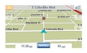
Image: Magellan 2010 Map Update by Magellan, courtesy of amazon.com
Advertisement


