Outdoor enthusiasts who plan on using their Garmin portable handheld GPS devices for any one of a number of activities like hiking, fishing, geocaching, and hunting will want to make sure they have Garmin Topo maps. Find out what they are and where to get them here.
Topographic Map Basics
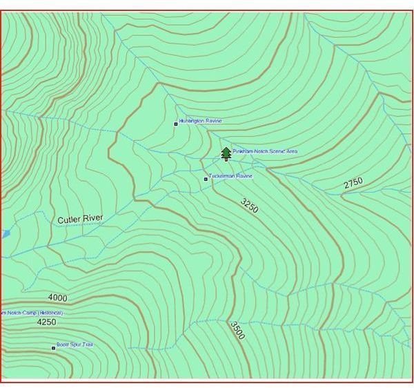
First of all, Topo is short for topographic if you didn’t already know that. Topography is the detailed mapping of surface features such as mountains, depressions, rivers, lakes, as well as constructed features be it a dam, railroad, forest service road, or trail. Contour lines are a prominent feature on this type of map that enables a person to accurately identify their surroundings and orientation by identifying terrain features. Contour lines connect points on a map that are at the same elevation.
So the contour lines of something like a steep mountain ridge would be close together. Although they are stacked together on the GPS map two dimensionally it helps to look at them as if they were three dimensional and grew up from the map as the elevation of the land it represents grew to its pinnacle. I’m sure that kind of technology will be here before we know it anyway. The distance between vertically spaced contour lines is different on some maps therefore you must check the legend to see if they’re 20 or 80 feet, for example. The contour spacing for an individual maps, however, is always constant. The hillier, mountainous terrain will have a greater distance between lines to prevent the map from being overcrowded with lines.
In the United States, a government agency known as the U.S. Geological Survey began a comprehensive mapping of the U.S. in 1979. The preeminent USGS maps are 1:24,000-scale topographic maps, also known as 7.5-minute quadrangles. They finished their work in 1992 and many of the digitized maps found on GPS screens are related to their efforts. Garmin GPS maps are typically on a 1:100,000 scale.
Incidentally, if you’re in the market and searching for the best Garmin for a given outdoor activity, click on the link for each of the following; Geocaching , backpacking , fishing , and hunting.
How to get Topo Maps for your Garmin
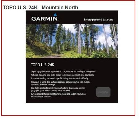
Now that we’ve covered a little general information, let’s move on to how you can get your Garmin GPS Topo maps in order for you take the roads and trails less travelled. The Topo maps Garmin offers are highly detailed with the outdoor enthusiast in mind. You can get them for large areas such as the entire U.S., Great Britain, or for more specific areas with added details and features such as the Northwest, National Parks, and popular ski resorts. For instance, a lot of the places I like to explore in the wilderness areas in Montana are covered in great detail on U.S. 24K - Mountain North .
Depending upon the map you choose and the specific type of Garmin device you have you can upload these maps via CD Rom, preloaded SD and Micro SD card, or right off the internet with a USB cable. The Garmin website will provide you with that compatibility information.
National Geographic also has some highly detailed Topos which are especially known for the accuracy in plotting waypoints and some hard core outdoor enthusiasts swear by their superiority. Again, you’ll have to find out if your particular device is compatible, but they are outstanding maps for the wilder places in the world.
This post is part of the series: Garmin GPS Maps Tutorial
Find out everything you need to know about the large variety of Garmin MapSource, Garmin GPS maps, including Topos, and how to download and access them in order to get exactly the right Garmin handheld GPS maps catered to the specific Garmin device you own in this five part series.


