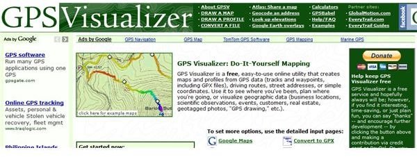
GPS Visualizer is an online utility for mapping and all related tasks like file conversion of files containing location data. The different tools can be used individually as each of them has a dedicated page on the site.
If you are a fan of geocaching, exploration, mapmaking or working with maps in general, things would be easier for you if you can have some kind of control over how maps look and what kind of information they contain. That is what this visualizer offers you via its online interface. It lets you use data from GPS files, Google Map routes, spreadsheets, plain text files and other files in different formats to create a map of waypoints.
Convenience (4 out of 5)
The level of ease of using this free online GPS tool is ideal for beginners and advanced navigators alike. It has a fairly simple and straightforward user interface that does not require a lot of effort from you in importing the information you are going to use to create maps. The simplest way for you to do this is to upload the file you are going to use and let the utility do the rest. You can’t get any simpler than that.
You can also input data manually if you have the time. This lets you have full control of the data you want the utility to use. This is extremely useful if you do not have your data in a formatted file. Instead of exerting effort in formatting the data, you can input it directly into the utility and have it generate a map for you in just a few steps.
If you prefer a more visual approach and making maps, the online utility also has a graphic interface that is based on Google Maps. In this graphic interface, you can place geocache and other map elements into your map and see how it looks as you are creating it. This type of editing is commonly known as WYSIWYG, or What You See Is What You get . The convenience and efficiency of the utility makes mapmaking easier, faster and better no matter what mode of map creation you prefer.
Conversion (3 out of 5)
Aside from using location data to create maps, this online tool can also be used to convert location information files into other formats. To be specific, GPX files can be converted into a plain text file with appropriate formatting that includes tabs, commas and other relevant punctuation marks. It can also give you the latitude and the longitude of certain post code addresses, which means if you simply have to get this particular information, you can still use the site without bothering with the other features.
User Experience (4 out of 5)
Overall, GPS Visualizer is a powerful online utility for mapping tasks. It has a simple layout and design that makes viewing the site easy on the eyes. Navigation is not as intuitive as you want because of the sheer number of tools and links that make the site pages look like it has a lot of clutter, but once you get used to the location of the different features and how things work, navigation within the site will be as easy as using the site’s tools. The best part about this online utility is that it is absolutely free.
References
https://www.gpsvisualizer.com/
Photo Courtesy of GPS Visualizer