GPS satellite signals are relatively low and you might be amazed to discover what that power level is equivalent to in something you use in your home every day. Find out how far that signal is travelling from, how fast it goes, what it contains, and the obstacles GPS faces to remain effective.
GPS Satellite Signal Strength is Low and Travels Far
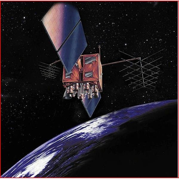
Learning a bit about the basics of GPS satellite signals will help you understand the amazing technology on the other end of the proverbial line that enables your device to know exactly where it is at a given time. So let’s start with the fact that the actual signal transmitting from those GPS-dedicated satellites in space to GPS receivers on the ground are relatively weak and low. That signal has to travel through space, our atmosphere, and anything from buildings to heavily canopied forests to get to a receiver. How low is the signal strength? The 50 Hz signal strength can be equated to that of a 50 watt domestic light bulb. Comparatively speaking, a TV tower that is only 15 miles away will transmit a signal that could be as much as 10,000 watts. Enhancing the code to measure GPS signal strength gives you an in-depth look into how and why it is measured. Obviously, since civilian GPS units have been consistently reliable navigational aids for years, the weak signal is still getting the job done despite its relatively low position on the scale. First of all, those orbiting satellites (all 24 of them) are roughly 11,000 miles away from any receiver here on Earth. The satellites themselves are tiny in the vast scheme of things, plus they’re moving, so it’s rather astounding that the system even works at all. But GPS signals travel at the speed of light and the satellites transmit in a repeating, synchronized sequence due to the accuracy of the built-in atomic clocks which account for how accurate each satellite is at tracking time .
Image courtesy of commons.wikimedia.org
What Data Does That Signal Contain?
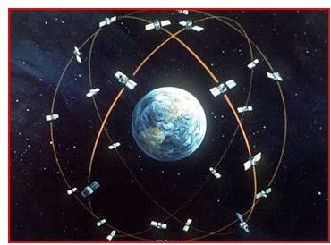
One signal from a satellite is called a pseudo-random code and each GPS satellite is programmed to send it out at different times. GPS receivers recognize this signal and repeat it to determine their travel time from those satellites. Pseudo-random code also allows the receiver to identify which GPS satellite is transmitting this data. Besides pseudo-random code, a GPS signal contains two additional pieces of information: Almanac and Ephemeris data . The former reveals orbital courses so that a receiver will know which satellites will be in the skies above them for tracking purposes. Ephemeris data instructs a receiver as to where every satellite will be at any time. This information is exclusive to each satellite, therefore with this information is responsible for giving a receiver precise positioning coordinates. GPS satellites also send out two radio signals which are called L1 and L2. Civilians utilize L1 which is unencrypted and measured at 1575.42 MHz. L2 is what the military uses so it is encrypted and more accurate, measured at 1227.6 MHz. How GPS Satellite Detection Sensitivity Affects the Accuracy of GPS delves far more deeply into these technicalities.
Image courtesy of commons.wikimedia.org
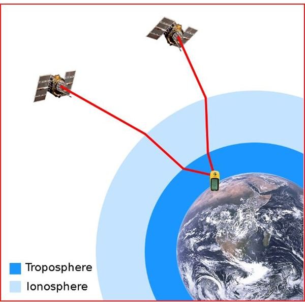
Some Common Causes of GPS Signal Errors
-
 Advertisement
As the signal passes through the atmosphere, delays can occur in the ionosphere and troposphere but GPS systems have built-in calculators to account for this.
-
Sometimes signals bounce off large rocks or buildings before making it to a receiver.
Advertisement -
Orbital errors which are known as ephemeris errors, can sometimes cause inaccurate reading for the satellites position
-
When GPS satellites are in a tight grouping or in a line, readings won’t be quite as accurate as when they are at wide angles to each other.
Advertisement -
Unintentional electronic interference and the intentional variety, known as GPS jamming and spoofing that are a recognized vulnerability to GPS technology , are issues that scientists and the government are trying to protect us from.
Image courtesy of commons.wikimedia.org
References
https://www.navsync.com/notes1.html
https://www.pocketgpsworld.com/howgpsworks.php


