There are several options for viewing satellite images besides Google Maps. Yahoo! Maps and MapQuest Maps are great alternatives to Google map satellite images. Lesser known applications like World Wind and Ossimplanet provide useful satellite imagery tools.
Anybody can access satellite images with a computer and an internet connection. Google Maps feature detailed satellite imagery of nearly any location on the planet. It’s probably the best tool available online, but there are other mapping sites and applications that provide quality satellite images as well. These include MapQuest, Yahoo! Maps, World Wind, and Ossimplanet.
MapQuest
One alternative to Google Map satellite images is MapQuest. In addition to the accurate turn by turn directions and 360 degree street view option, MapQuest provides a view from the skies through its satellite image feature. Easily switch between a map view and satellite view with a click. The option is on the top right of the map. You can zoom into a location and see very detailed images. Simply click on the ‘+’ side of the zoom bar to narrow the view. To zoom out, click on the ‘-’ side of the zoom bar.
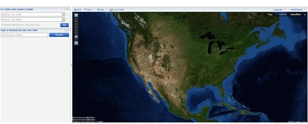
Yahoo! Maps
Yahoo! Maps provides satellite images to complement its standard map features. Like MapQuest, Yahoo! Maps switches seamlessly between a standard map view and a satellite view with one click. There is a third option on the upper right section of the map labeled ‘hybrid.’ This incorporates many of the standard map features onto a satellite image. There is a zoom bar which lets you adjust the level of detail of the image. Zoom in to see something specific, or zoom out to get a macroscopic view.
World Wind
Another alternative to Google Map satellite images is a little known application called World Wind Java SDK. It was developed by the National Aeronautics and Space Administration (NASA) and is available for developers. To be able to use it, the computer must have a 3D video card with updated drivers. You can pan, zoom, tilt, and reset heading with the mouse. The basic display features a globe, stars, world map, atmospheric effects, a compass, and scale bar. World Wind can be used to display several types of images including surface imagery, rigid shapes, extruded shapes, and surface shapes.
Ossimplanet
Ossimplanet is another application that can display satellite images. Like World Wind, Ossimplanet displays 3D images of the surface. It utilizes some of the aspects of OSSIM and OpenSceneGraph. The application is compatible with topography data from DTED and SRTM. Portions of Ossimplanet can be accessed online via OGC WMS. Features include World Wind server support, remote collaboration, and open source software. This application is more suitable for developers than the average user looking for satellite images.
From these four options, it is clear that the best alternative to Google satellite images for the average internet user is MapQuest. It’s convenient online access and quick change over between a standard map and the satellite image give it an edge over similar satellite mapping sites. Yahoo! Maps’ ‘hybrid’ view blends a standard map and satellite image together, while MapQuest natively displays map information on the satellite image. You can remove the map labels on the satellite image in MapQuest by simply un-checking the ‘show labels’ box.
Reference
1. MapQuest. https://www.mapquest.com/
2. Yahoo! Maps. https://maps.yahoo.com/
3. World Wind Java SDK. https://worldwind.arc.nasa.gov/java/
4. Ossimplanet. https://www.ossim.org/OSSIM/ossimPlanet.html
Image Credit: Screenshot by author.


