Technology used to collect weather data employs a number of devices such as satellites and weather balloons to perform a very important function to our daily living; forecasting the weather. It is especially so for our transport services that depend on the weather forecast to ensure passenger safety
Introduction to Technology Used to Collect Weather Data
Most of us watch or listen to the daily weather forecasts given out by the media to see what the weather is going to be like for our particular area. More importantly, airline and shipping companies depend on current weather forecasts, which they check before setting off. The technology used to collect the data that the forecast is based upon has become very sophisticated, with new technology being frequently applied by our meteorological scientists to enable a reliable weather forecast. Modern technology is based on early instruments such as basic temperature gauges and barometers that were used to collect the data.
Here we examine the technology used to collect the weather data that our forecasters rely on.
Current Technology Used to Collect Weather Data - Balloons, Planes and Radar
Weather Balloons
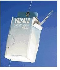
The weather balloon is normally fabricated from some type of latex that is filled with helium or hydrogen and launched by many countries at intervals of 12 hours. The instruments are suspended below the balloon much like a basket on a hot air balloon in a container known as a Radiosonde. Transponders send the information gathered back to the weather stations that share the data and use it to supplement sounding rocket, satellite and other means of atmospheric weather data collection methods.
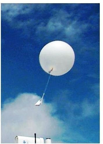
The weather balloon’s maximum height is about 24.85 miles (40km) where it disintegrates, and the Radiosonde floats back to earth on an integral parachute to be recovered.
The Radiosonde contains the following instruments;
- Thermometer – used to measure the ambient air temperature.
- Anemometer and Vane – used to measure wind speed and direction.
- Barometer – used to measure atmospheric pressure.
- Hygrometer – used to measure humidity
Remo****te Control (Robotic) Planes
These are also known as drones or Unmanned Aircraft Vehicles (UAV) and are used to fly unto hazardous areas such as into the eye of hurricanes to collect weather data. They are also used to record atmospheric weather parameters at very low altitudes over the sea that would be dangerous for conventional flight, as well as for monitoring Arctic and Antarctic ice patterns and alterations.
Doppler Radar
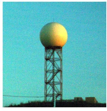
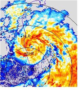
Doppler radar is a specialist radar that uses the doppler effect to show the velocities of objects at different distances. It achieves this by firing microwave beams at the object and then recording its reflection. This radar produces the weather images we are most used to seeing on television weather forecasts. An example of a Doppler radar can be seen in the form of a handheld gun used by the traffic police to check our speed!
The device beams the microwaves from an antenna towards the object, which in our case is precipitation clouds or severe weather coming in. The signals are sent back to the antenna where they are fed into a computer and plotted onto a map. The radar can detect whether the precipitation is moving towards or away from the location of the antenna, but other atmospheric conditions are required before meteorologists can confirm if it is rain, hail, sleet, or snow.
The radar can also detect and follow storms, cyclones, and hurricanes. Some images of these and a typical Doppler Radar Tower are shown below. Please click to enlarge the image.
Current Technology Used to Collect Weather Data - Weather Satellites and Rockets
As we have seen, satellites have been used to provide data on world weather systems since the early sixties.
There are two types of satellites; Geostationary Operational Environmental Satellites (GOES) and Polar Orbiting Environmental Satellites, which complement each other to give a complete picture of world weather.
Geostationary Operational Environmental Satellites (GOES)
Modern GOES used by National Oceanic and Atmospheric Administration’s (NOAA) operate at up to approximately 22,245 miles (35,800 km) above the Earth’s surface, recording the changes in atmospheric conditions in space that are triggers for hurricanes or tornadoes, thus enabling severe weather warnings to be issued.
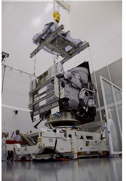
Instruments aboard the GOES Satellites collect the following data through a Visible and Infrared Spin Scan Radiometer (VISSR), a high technology device that measures the vertical structure of water vapor and temperature in the atmosphere over specific locations. This allows the following data to be collected;
- Images of cloud and snow formation
- Wind information from cloud motion.
- Estimates of precipitation.
- Air and sea temperature.
Polar Orbiting Environmental Satellites
These satellites circle the earth at approximately 515 to 528 miles (830 to 850 km) in a North/South orbit sending regular images back to earth. This enables the onboard instruments (VISSR) to monitor and record global atmospheric conditions and cloud data by collecting numerous weather parameters that affect weather patterns.
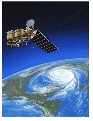
All this data from both types of satellites is fed into weather models to produce accurate weather forecasts.
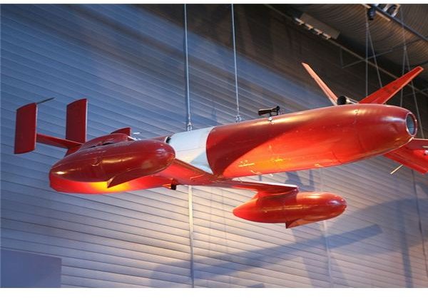
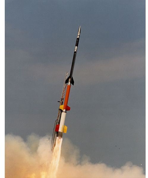
Sounding Rocket
The sounding rocket is driven by a solid/liquid fuel motor and incorporates a Radiosonde containing weather data recording instruments similar to the hot air balloon to altitudes between approximately 621 to 932 miles (1000 and 1500km.)
The rocket flight averages 20 minutes transmitting data such as wind speed and direction, air pressure and temperature as well as atmospheric humidity. When it reaches full trajectory, the Radiosonde is released and falls to Earth under an integral parachute.
An image of a modern Sounding Rocket is shown below, please click to enlarge.
Summary
The technology used to collect weather data consist of equipment that contains various weather processing measuring devices, which transmit the information to weather stations all over the world.
The equipment ranges from weather balloons; the oldest type, to modern equipment such as remote controlled planes or drones.
Satellites and sounding rockets are also used to gather information on space weather conditions and to monitor hurricanes, tornados, and cyclones. This is transmitted to earth and enables meteorologists to issue severe weather warnings.
Websites Visited
- https://www.noaa.gov/wx.html
- https://www.sciencedaily.com/releases/2006/08/060825132313.htm
- https://www.altiusdirectory.com/Computers/weather-technology.html
- https://space.rice.edu/ISTP/
- https://www.greatweather.co.uk/
This post is part of the series: Weather Forecasting
This series will incorporate several articles on weather forecasting, the instruments used, and the devices such as satellites that carry the instruments and collect weather data from space, atmosphere, and the world’s oceans.