GPS technology with RTK augmentation provides accuracies in inches or less. If this is used to navigate your farm equipment for planting, harvesting, spraying pesticides and herbicides, or applying fertilizers accurately, yield can be improved significantly. You can earn back the investment quickly.
Introduction
GPS on tractors can help steer them very accurately to make precision farming possible. The benefits of precision agriculture include increased productivity and more economical farming. These benefits accrue from the fact that the farmer is able to carry out his operations night or day and in difficult visibility conditions such fog, rain, or dust. Along with precision GIS mapping of soil conditions, data collection and analysis, he is also able to know his farm conditions very accurately and apply chemicals in the form of pesticides or herbicides, and arrange planting and harvesting so accurately that it can save him quite a bit of money. No areas get skipped or done more than once. Yield data can be monitored very accurately so that even more accurate inputs can be applied next season.
All this is possible with an accurate GPS receiver and using it for steering the farming platform or tractor. Use these in conjunction with accurate GIS map and you are in business. The productivity increases can easily pay for the cost of the additional equipment you are going to need. For a quick view of what exactly precision farming is and how GPS and GIS technology is helping it, visit this US Govt. site .
GPS Accuracy
Commercially available GPS receivers provide you with 3 meters to 5 meters accuracy. That’s roughly a little more than 3 yards to 5 yards (add 3 inches per yard to get a closer number). However, this is not good enough to let the tractor drive itself. You would also miss soil areas where adjustments in chemical application or planting need to be done. There is a way around this problem: RTK or real time kinematic GPS systems can provide sub-inch accuracy. The precision can be up to a centimeter. A base station sends out a corrective signal that can be used by several moving stations to arrive at accurate positions.
What you need is one such set up and a GPS-based tractor auto–steer set up per tractor that you want to run. The accurate readings obtained by these on-board GPS are used to steer the vehicles. The auto steer system also takes the attitude of the vehicle (roll, yaw and pitch angles) into account so that undulations in the field are handled.
Real Time Kinematics
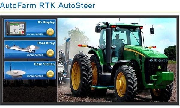
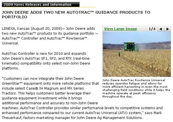
The RTK-based GPS systems can compensate for atmospheric delay, orbital errors, and other variables in GPS geometry. Because of the accuracy that can be derived, it is used by engineers, topographers, surveyors, and others in applications in civil engineering and dredging, and now in precision farming. RTK systems use the Wide Area Augmentation System (WAAS) to generate initial corrections. The base station receives the corrections transmitted by the WAAS system and correct them further. Typically you can get 1.0 metre (3 ft 3 in) laterally and 1.5 meters (4 ft 11 in) vertically correct data. RTK provides differential corrections to produce the most precise GPS positioning. Typical corrections derived by current RTK systems are up to 1 cm. System examples can be found from John Deere , Trimble , AutoFarm , and Garmin . John Deere, for example, provide you with precise corrections and charge a monthly subscription for it. Sauer-Danfoss is an example of a company who provide steering subsystems. If your skills include the ability to assemble systems, this could be a good source.
Auto-Steer Systems
Auto-steer systems use the corrected GPS signals from base stations that are transmitted to moving tractors. These tractors are then steered automatically to follow a path. The movement commands take into account the roll, yaw, and pitch attitudes of the vehicle. The outlay for equipment may vary over a wide range from about $10,000 to $30,000. Good equipment is available in the $20,000 to $30,000 range. Hopefully we have provided the necessary pointers to launch you in the right direction.
You can view couple of examples in the following image section.
Images