Continental Shelf of the United States
A continental shelf sounds like it should be a definite scientifically defined region but this isn’t always the case. With the advent of underwater mining and drilling methods, the continental shelf became a region that could be exploited by countries that bordered these areas.
Just how far the continental shelf extended then became an issue of political and economical importance. Before we discuss the political and economic changes to the definition of the continental shelf, it is best that we look at the strict scientific definition.
Geographical Definition
The definition of a continental shelf is the area between the ocean banks and the neritic zone. However, that is a bit too technical especially since most of us have no idea what a neritic region is or what constitutes an ocean bank.
A better definition is given by Francis Shepard in Submarine Geology (3rd edition, 1973, Harper and Row), where he says continental shelves are “the shallow platforms or terraces that surround most of the continents and are terminated seaward by a relatively sharp break in slope, called the shelf edge or shelf break.” This definition suits our needs far better. To extend this a bit, think of it like this: the continental shelf is where the edge of the continent was during the ice age.
A continental shelf by this definition could extend any distance from the shore of a country. In general this ranges from 12 nautical miles from shore to over 200 nautical miles. The distance is very rarely consistent for any length of shoreline so this definition while great as a scientific definition fails to work on a political level.
Geopolitical Definition
After several attempts to adequately define the geopolitical boundaries of the continental shelf. the United Nations convened a hearing on this subject in 1973. In Article 76 of the United Nations Convention on the Law of the Sea, they agreed to define the continental shelf as follows: a region that extends 200 nautical miles from a sovereign nation’s coastal baselines or in layman’s terms, the stretch of the seabed adjacent to the shores of a particular country to which it belongs also known as territorial waters.
U.S. Continental Shelf
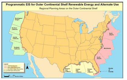
The continental shelf of the United States is divided into four sections:
- Atlantic Outer Continental Shelf
- Pacific Outer Continental Shelf
- Gulf of Mexico Continental Shelf
- Alaskan Outer Continental Shelf
These regions are further divided in the Atlantic and Pacific to include north, mid, and south regions. This is peculiar to the United States. Each individual state is afforded control of the first nine nautical miles from the coastline so that federal jurisdiction doesn’t apply until that point.
The U.S. Federal Government thus controls the area from 9 nautical miles to 200 nautical miles from the coast. In some areas, if the continental shelf can be shown to extend past the 200 nautical mile mark, an area up to 100 nautical miles or the region that the shelf extends to can be claimed by the country.
The importance of this geopolitical definition can be seen in information on the U.S. Department of State website. The U.S. Department of State claims that “preliminary studies have indicated that the U.S. Extended Continental Shelf (ECS) likely totals at least one million square kilometers – an area about twice the size of California”, and that, “given the size of the U.S. continental shelf, the resources we might find there may be worth many billions if not trillions of dollars.”
While you may think of resources such as gas and oil that can be drilled for in the shallow region of the continental shelf, the vast majority of resources are marine fish. The crab and lobster industries are major economical centers and provide a great deal of money to the Atlantic and Alaskan shelf regions. There are also several rare minerals found in large enough quantity to warrant underwater extraction. These include diamonds, chromite (chromium ore), ilmenite (titanium ore), magnetite (iron ore), platinum and gold.
The purely economic reasoning for the geopolitical definition of the continental shelf of the United States doesn’t mean that we can ignore the geographical definition; it just means that we need to treat it in the same way as we treat country borders in respect to natural geological formations. For example, the northern border of the United States with Canada isn’t defined by a change in geography but rather by agreed upon boundaries. This is essentially what has been done in the case of the continental shelf. The geographical definition is essential in defining the habitats of marine wildlife as well as explaining several natural phenomenon from weather patterns to seasonal migration of species.
In any case, the continental shelf has two very different definitions so when you are using it be sure that you clearly define it as either geographical or geopolitical to avoid any confusion.
References
- “Defining the Limits of the U.S. Continental Shelf.” U.S. Department of State. Web. 25 Aug. 2011. http://www.state.gov/g/oes/continentalshelf/index.htm
- Image courtesy of the USGS, http://www.google.com/imgres?q=us+continental+shelf&hl=en&gbv=2&tbm=isch&tbnid=h8wm2D9BjlgRDM:&imgrefurl=http://ocsenergy.anl.gov/guide/ocs/index.cfm&docid=zQKwJHFbbRFgbM&w=400&h=253&ei=qZxWToewH8PcgQfA16CnDA&zoom=1&iact=hc&vpx=171&vpy=95&dur=1638&hovh=178&hovw=282&tx=158&ty=89&page=1&tbnh=119&tbnw=188&start=0&ndsp=19&ved=1t:429,r:0,s:0&biw=1366&bih=566
- Extended Continental Shelf Project. Web. 25 Aug. 2011. http://continentalshelf.gov/