Learn the History of Global Positioning System (GPS)
How GPS Began
The history of global positioning systems or GPS really began with the Department of Defense (DOD). GPS started like many other modern technologies, including the Internet: the government and U.S. Military.
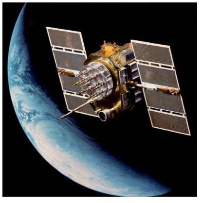
Image Credit: Navstar II courtesy of US Air Force/Wikimedia Commons.
Sputnik
The history of GPS really began in 1957 with the launch of the Russian satellite Sputnik. The Massachusetts Institute of Technology (MIT) noticed that the satellite’s signal varied in strength depending on its position. This varying in signal strength allowed the researches to accurately predict the location of the satellite.
Then, the knowledge gathered by Sputnik eventually led to the first GPS system. In 1972, the government decided to start putting together a GPS system based on technology already being used by both the U.S. Navy and Air Force.
The first GPS transmitters were installed in different areas in 1977, and these transmitters underwent extensive testing to determine if they would work.
Ivan Getting
Finally, Ivan Getting, an electrical engineer, in conjunction with the DOD and MIT came up with the basis for the first GPS system. In 1978, this GPS system started with only 11 orbiting satellites, and the project was named Navigation System with Timing And Ranging or NAVSTAR. The purpose of GPS was to help military personnel locate their position.
Ivan Getting had been a student at MIT in 1951 and he had created the first layout for GPS. He created a three-dimensional system that could find a person’s position. He did this by basing his information on the person’s arrival time. This would become the basis for modern day GPS.
Additional Satellites and Atomic Clock
In 1979, an additional 7 GPS satellites were added, bringing the total number to 18. Then, the government launched the first Block I satellite, and this satellite was for finding atomic explosions. The goal of this satellite was to determine if the Soviet Union was complying with the 1963 agreement to cease nuclear testing. In 1980 we saw the first atomic clocks, which measured time using changes in electron energy levels.
Ronald Reagan’s Role
GPS finally made it to the public sector in 1983. The government declassified the technology because the Korean Airline flight 007 got lost and wandered into Soviet airspace. The Soviet Union shot down the plane, killing all inside. President Ronald Reagan believed that GPS technology could have avoided this tragedy.
Block II Satellites
In the mid-1980s, the government came up with Block II satellites, which were supposed to be installed in 1986. But, the Challenger space shuttle disaster postponed the launch. Delta rockets were eventually used to launch the satellites into space, and the number of satellites was increased to 24 in 1988.
Modern Uses
Public use of GPS was temporarily halted during the Gulf War in 1990, but people were again allowed to use it 1993. The last of the 24 satellites was launched in July of 1995.
Presently, GPS is used for a variety of tasks from locating your current position to tracking lost pets. Further, more satellites are now in space along with improved accuracy. Originally, GPS could only locate someone within over 300 feet. That has improved to within less than 50 feet.
References
Maps-gps-info.com, https://www.maps-gps-info.com/gps-history.html