How is Hail Formed and Why Does It Form?
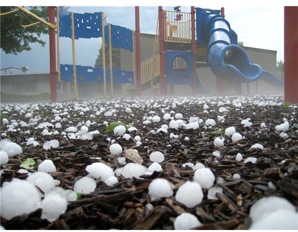
Hailstones can cause major damage to buildings and vehicles depending on the size they reach; in the central plains, there are commonly hailstones the size of softballs or even bigger. The largest hailstone ever documented was found in Vivian, South Dakota on July 23, 2010, and it was over 18.5 inches in circumference.
The former record holder was recovered in Aurora, Illinois in 2003. It measured an approximate 18.25 inches (because about 40 percent of it broke off when it hit a gutter), and no weight could be taken because it wasn’t preserved right away.
According to the University Corporation for Atmospheric Research (UCAR), “In Orient, Iowa, in August 1980, hail drifts were reported to be 2 meters (6 feet) deep. On 11 July 1990, softball-sized hail in Denver, Colorado, caused $625 million in property damage, mostly to automobiles and roofs. Forty-seven people at an amusement park were seriously injured when a power failure trapped them on a Ferris wheel and they were battered by softball-sized hail.”
How is hail formed in such massive proportions; in these cases, as large as a soccer ball, and how can such expensive damage be avoided?
Hail Formation
Hail is only formed under special conditions present in severe thunderstorms, but there are two different sets of circumstances that can cause it. The first situation happens when ice crystals, small raindrops, dust particles or any other suitable small object are caught in an updraft and thrust into the super cooled moisture near the top of the cumulonimbus cloud. Super cooled water vapor hits these particles and freezes on contact. As more vapor hits the forming stone, it eventually gets heavy enough to fall back down through the cloud where it may, or may not, get caught in another updraft and sent back into the super cooled region. The more times the hailstone is thrust into the upper region of the cloud, the larger it will get. The hailstone will grow until it is too heavy for the updraft to affect it.
The second way a hailstone can form, which was recently discovered, is when the super cooled water vapor builds around nuclei near the back edge of the storm and is pushed forward above the updraft region. These hailstones continue across the top of the cloud until they are sucked into a downdraft and hurtled toward the Earth. These hailstones are usually quite small because they are not bounced back into the super cooled region by any updraft.
Why Some Hailstones Are Clear and Others Cloudy
When hailstones form in different regions of the storm, they can have different physical properties. Hail is formed by two processes called wet growth and dry growth.
The temperature when the nuclei are struck by the super cooled liquid is the key to the physical composition of the resulting hailstone. If the stone is struck in an area where the temperature is near freezing, then the liquid will start to run around the hailstone until it freezes. This process is called wet growth and allows air bubbles to escape leaving extremely clear ice.
If the region where the stone is contacted by super cooled vapor is quite a bit below freezing, then dry growth occurs. This is when the vapor instantly freezes trapping the air bubbles inside. The resulting ice is cloudy.
A large hailstone is as unique as a snowflake. Each one has layers like an onion and if you cut it across the diameter, you can count the rings (like a tree) and determine how many times the hailstone was sent back to the top of the storm by the updraft.
The width of each ring shows how long the hailstone was suspended in the super cooled region on each journey up. A larger ring means it was balanced in the super cooled region for a long time while a thin one means it traveled through the region quickly. Some hailstones have only a few large rings, others have several small ones.
Hailstones also collide with each other while in the storm cell. They can fracture or start to melt and refreeze together forming irregular shapes. Sometimes a conglomerate hailstone can combine from several smaller ones and end up looking like a bunch of grapes.
Updraft Speed and Resulting Hail Size Chart
The speed of the wind in the updraft will determine the maximum size of the hailstones that a storm can produce. The higher the wind speed the larger the hailstones can be. This doesn’t mean the hailstones will be bigger, just that there is a chance of them getting larger.
The following chart from gives the NOAA estimates for updraft wind speed and approximate maximum hail size.

Difference Between Hail and Sleet
One of the common misconceptions is that sleet and hail are the interchangeable. This isn’t true. Sleet is rain that falls through freezing temperatures after it leaves the cloud and turns to ice on its way down while this is different than how hail is formed in the super cooled region of the storm near the top of the clouds. Sleet is more common in the winter when ground temperatures are lower than the air temperatures at the top of the storm where hail is more common in the summer when the opposite is true.
References
NOAA National Severe Storms Laboratory; Hail Basics, https://www.nssl.noaa.gov/primer/hail/hail_basics.html
Munoz, Rene, editor, “Fact Sheet: Hail,” UCAR, https://www.ucar.edu/communications/factsheets/Hail.html
Author unknown, “Largest Hail in U.S. History Found,” National Geographic News, https://news.nationalgeographic.com/news/2003/08/0804_030804_largesthailstone.html
Johnson, Mark, “Big Hail: Largest Hailstone Ever Found in South Dakota This Week,” http://www.newsnet5.com/dpp/weather/weather_news/Big-hail-Largest-hailstone-ever-found-in-South-Dakota-this-week
Author unknown, “Why does hail form and how does hail form?”, Premium Weather, https://www.tornadochaser.net/hail.html
Hailstone Image courtesy of back_garage @ FlickR,
Hailstone size chart courtesy of NOAA